
Creating your own Google Earth charts
 |
Creating your own Google Earth charts is straight forward Thanks to the free software GE2KAP and OpenCPN, Google Earth charts are a great aid in navigation. |
The best software for sailors is sometimes written by sailors themselves. A perfect example is the "GE2KAP " program developed by Paul Higgins. The software converts a Google earth image directly to a BSB/KAP chart, which can be displayed with free software such as OpenCPN. And the best feature is that you don't have to perform any calibrations, since GE2KAP get's the calibration data directly from Google earth (using ActiveX API). The latest GE2KAP version can even overlay OpenCPN charts and Google earth images. You can download the software for free on Paul's GdayII web site (http://www.gdayii.ca/Downloads.php)
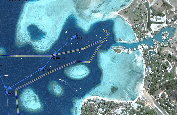
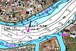
A chart created by GE2KAP showing our planned route and actual track on a Google Earth image. Approach to Musket
Cove in Fiji.
In order to make it work, you need to follow a few steps:
1) First install the oorexx interpreter, since GE2KAP is written in the REXX programming language. The lastest version of oorexx can be downloaded here:
http://sourceforge.net/projects/oorexx/files/oorexx/4.2.0/
Scroll down the page and pick the file for your operation system. For example if you use windows (32-bit) click on ooRexx-4.2.0.windows.x86_32.exe - see image below. Once the download is completed, double click it and follow the installation instructions.
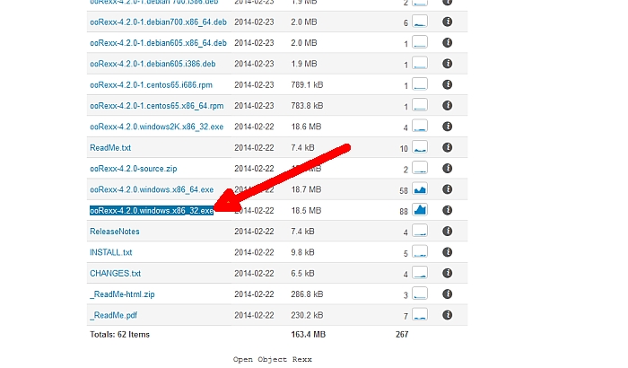
Download the oorexx interpreter for Windows (32-bit)
2) Download GE2KAP itself if you haven't done so yet: http://www.gdayii.ca/Downloads.php
3) Get Google Earth (V5.1 or higher) from Google:
http://www.google.com/earth/download/ge/agree.html
4) Start GE2KAP by double clicking on it from Windows explorer. If you click the Help button you can read the instructions on setting up Google earth. Be sure you turn off 'Terrain' as it can cause GE2KAP to create inaccurate charts. Also make sure that tilt and compass in Google Earth is reset (View > Reset > Tilt an Compass) otherwise the edges of your chart will look bend.
GE2KAP will automatically start Google Earth.
5) Next display an area on Google Earth that you would like to create a chart for, then go back to the GE2KAP window and enter the location where you want to put the chart, name it, and click on 'Create Chart'. Give it a few seconds and you chart is created.
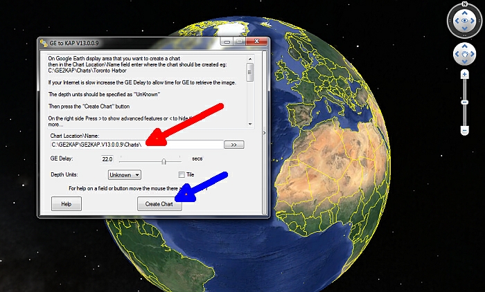
After you have chosen the desired area in Google maps, return to the GE2KAP window, enter file location and name
(red arrow) and click on "create chart" (blue arrow).
For a step to step tutorial on how to load your Google Earth charts into OpenCPN check out our blog about "Google Erath charts to navigate Fiji".
And finally, yes the GE2KAP is free but if you're happy with it, Paul and his dog Whitey would appreciate a donation: http://www.gdayii.ca/ :-)
Hits: 15616